The maps below are attempts to highlight topographical features of the terrestrial planets (including the Moon) in a more easily grasped way.
For some technical details, these used the SHTOOLS package, which makes use of spherical harmonic representations of the planet surface. This also makes it easy to compute local slopes, and use that information in shading. The shading highlights steep slopes and gives it the appearance of being illuminated. I chose to use a Robinson projection for a reasonable compromise between reproducing area and shape across the surface.
Mercury
This map uses the USGS_SPG_shape harmonics (order 5759), and the Scientific colour map GrayC_20.
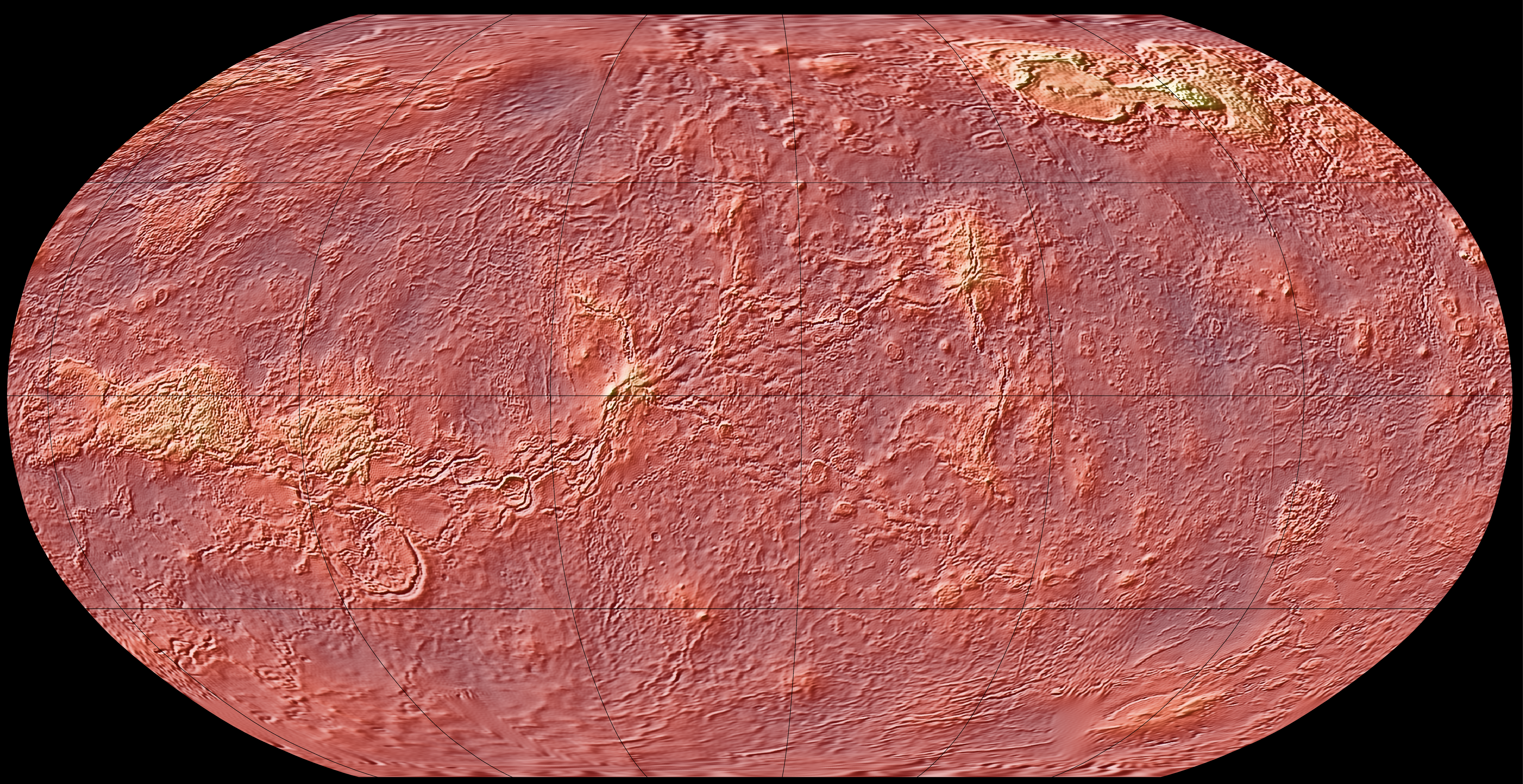
Venus
This map makes use of information from the Pioneer and Venera probes to help fill in some of the gaps in Magellan radar data (the VenusTopo719 harmonics). I centered on a longitude of -130 degrees so that both Ishtar Terra in the north and Aphrodite Terra just below the equator are visible, but also that the long chain of valleys connected to the east end of Aphrodite are shown completely. The map itself uses the Scientific colour map Lipari.
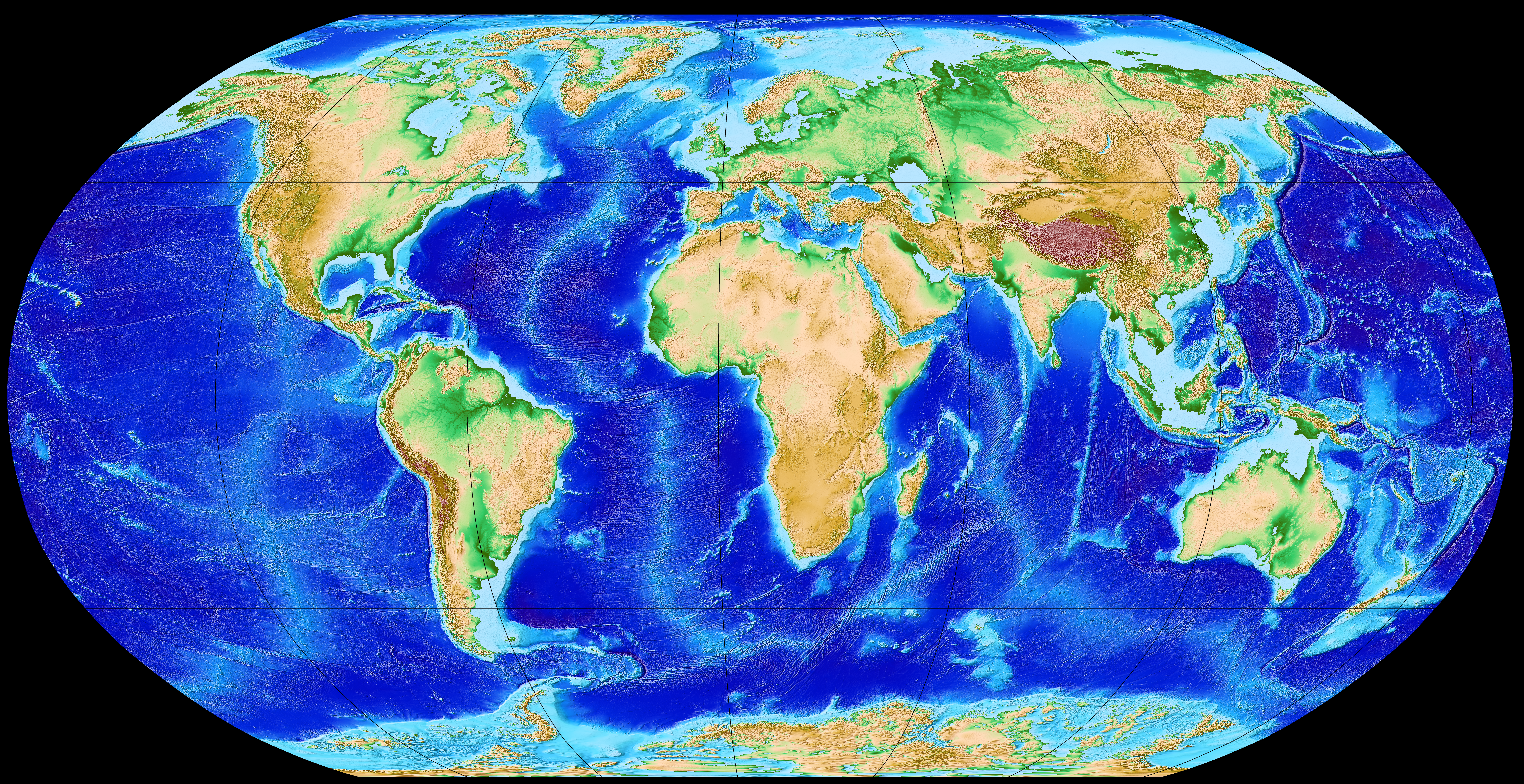
Earth
This map uses the Earth2014 (order 10800) harmonics, with bedrock data (erasing the ice sheets in Antarctica and Greenland). The color map has a lot of variation near sea level in order to help pick out continental shelves and familiar topographic features on land.
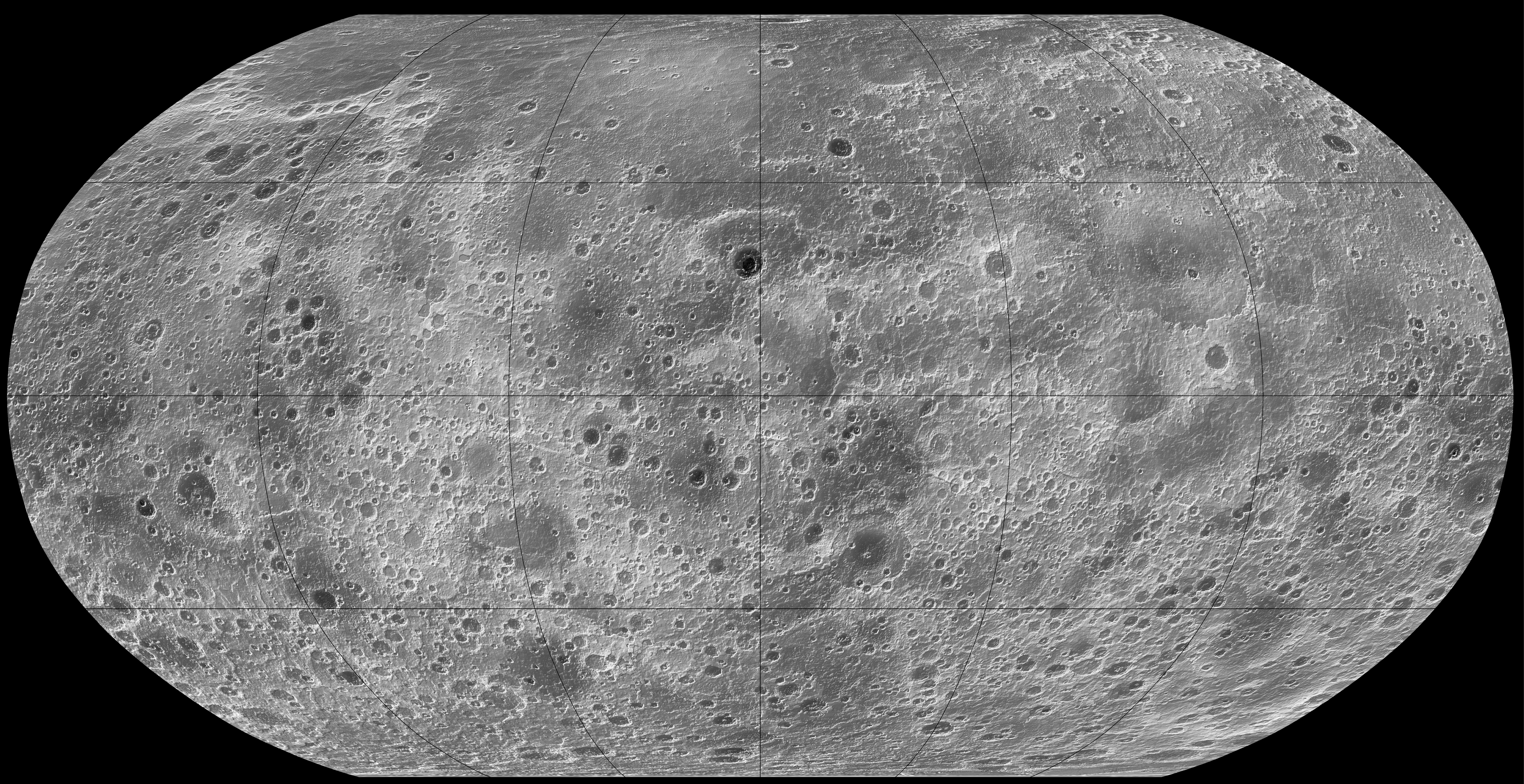
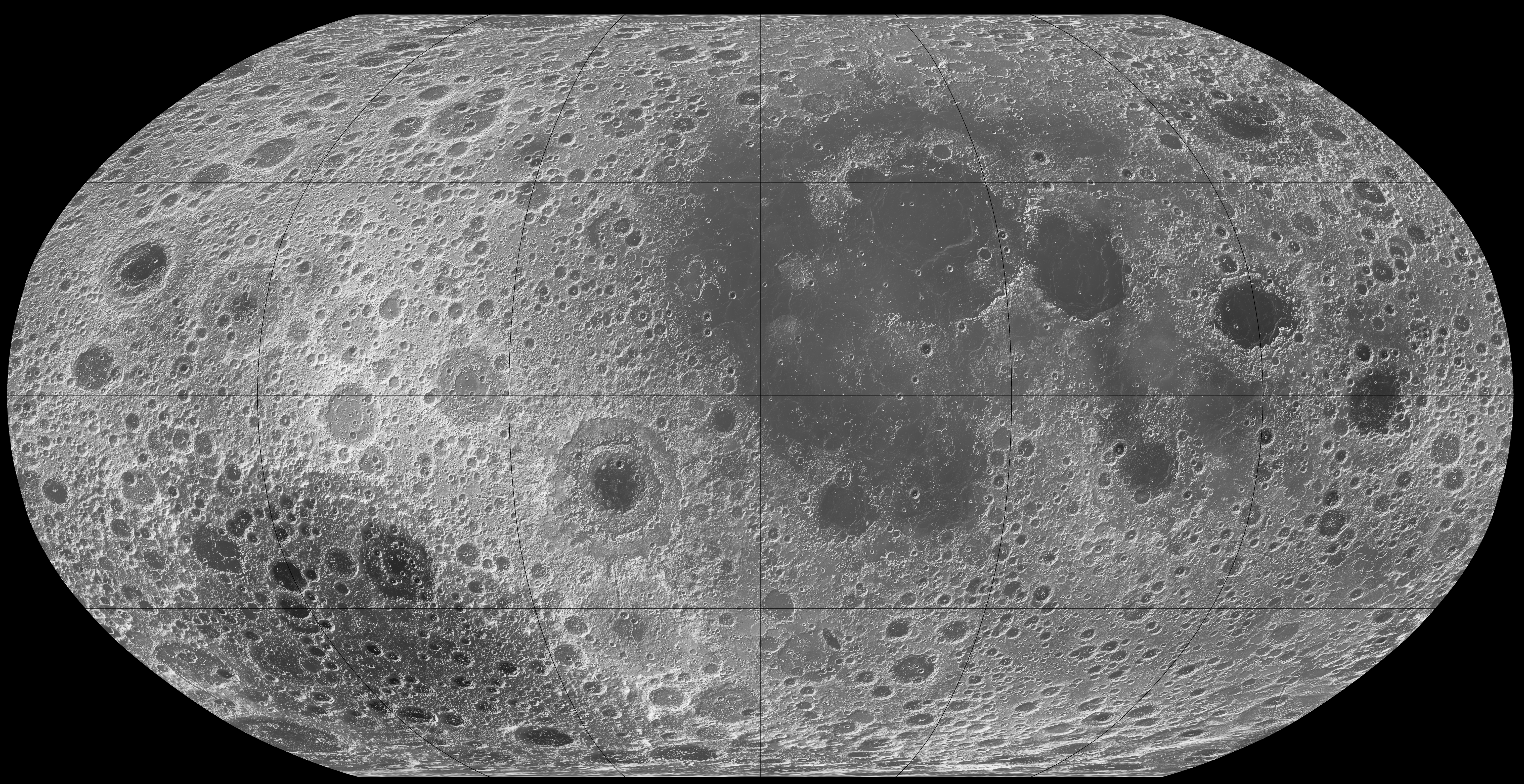
Luna
This map is intentionally not centered on the near side of the Moon in order to highlight the depth of the giant Aitken basin on the far side that we aren’t as familiar with. This uses the LOLA_shape dataset (order 5759 harmonics), and the Scientific colour map GrayC_20.
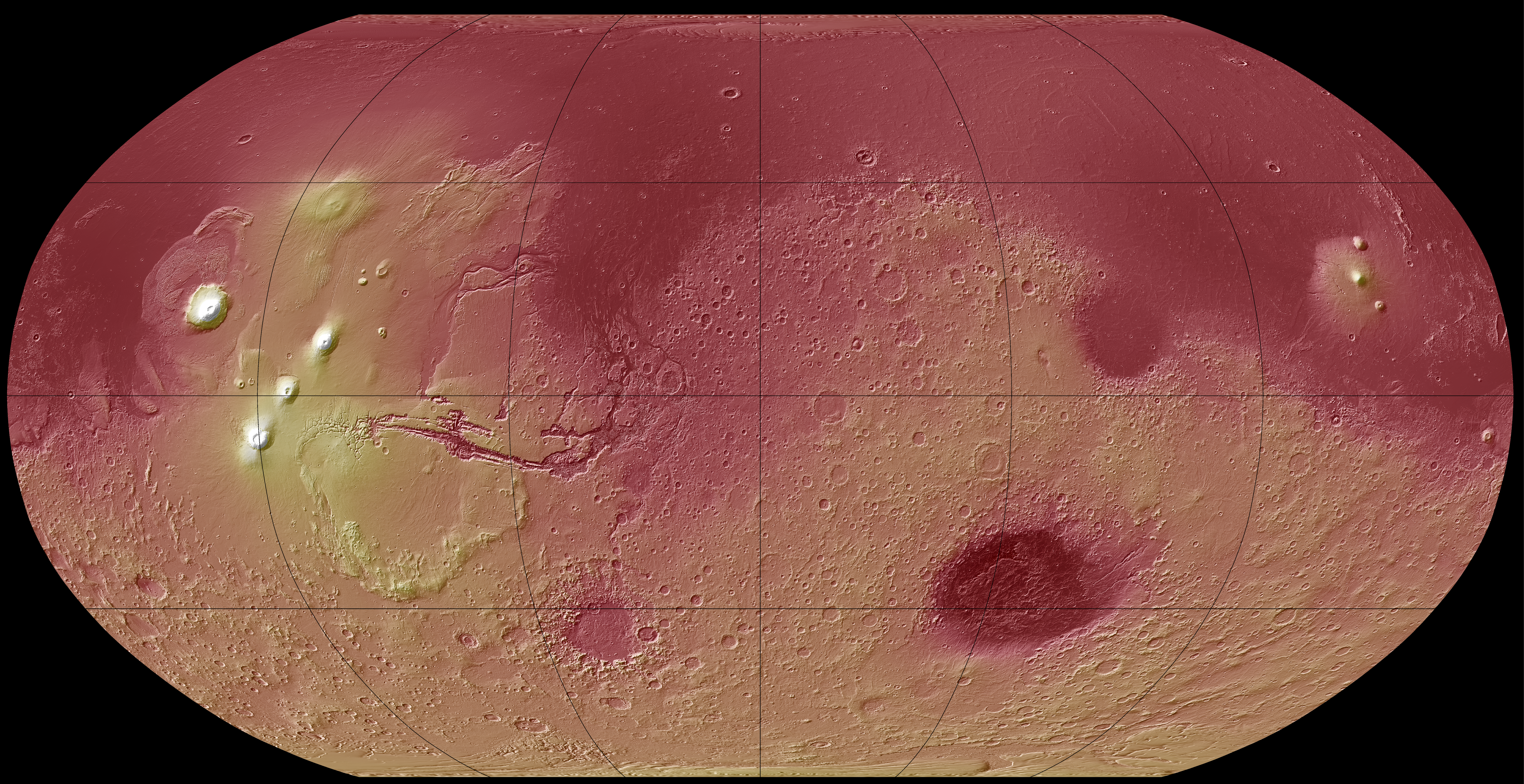
Mars
This uses the MOLA_shape data (order 5759 harmonics), and the Scientific colour map Bilbao. The large volcanos really pop out in elevation.